6.000 anni di urbanizzazione
Res publica 12.06.16
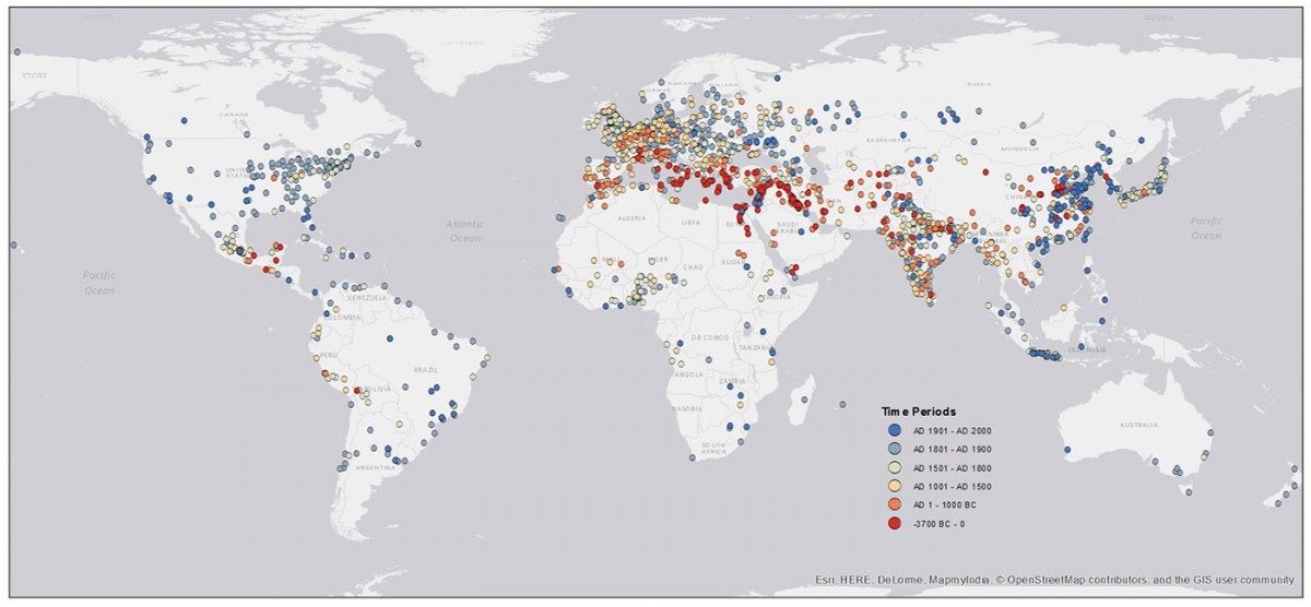
La mappa della storia dell'urbanizzazione di tutte le maggiori città, a partire dal 3.700 a.C., creata dai ricercatori della Yale University e della University of Canterbury.
In this graphic the spatial coverage of points represents all cities included in the final dataset. Cities recording the earliest first population data point are pictured in red and are centered near Mesopotamia, while cities with the most recent first population data point are pictured in dark blue. It is important to note that the first population point for each city does not necessarily indicate its origin as a city.


consigliato da Rhadamanth
