tizianocavigliablog

I post con tag "Mars Reconnaissance Orbiter" archivio

Il cratere Aram Chaos su Marte

Geek   16.08.23  

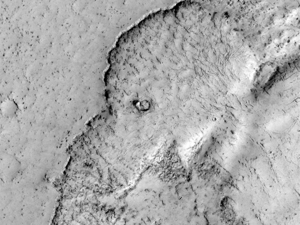
L'Aram Chaos è uno dei numerosi crateri presenti sulla superficie di Marte, ma ciò che lo rende particolarmente affascinante è la sua topografia unica e la storia geologica che cela.
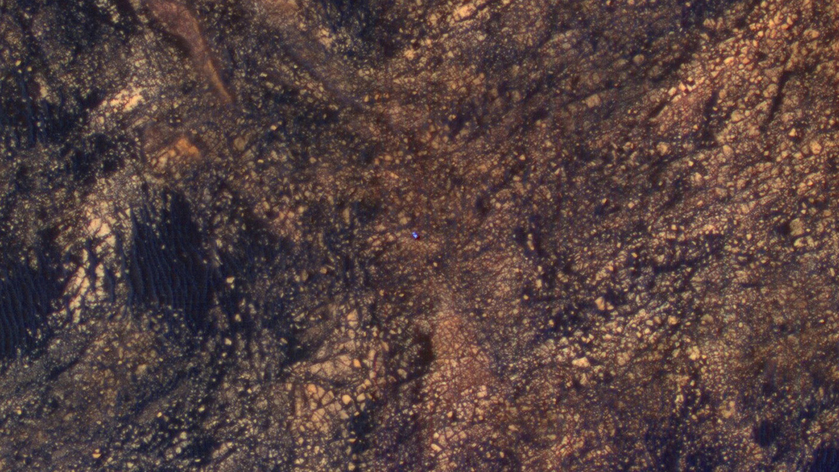
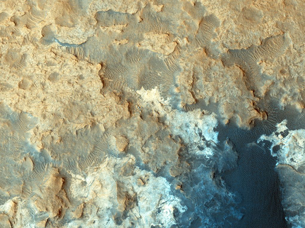
Le immagini, riprese dalla telecamera HiRISE a bordo del Mars Reconnaissance Orbiter ed elaborate attraverso bande cromatiche per evidenziare meglio la struttura e la geologia rispetto ai colori naturali, ci mostrano un paesaggio accidentato, segnato da creste e depressioni profonde, che testimoniano l'antico impatto che ha dato origine a questo cratere.

Attraverso questi filtro di colore, possiamo percepire i differenti tipi di rocce presenti nell'area circostante. Il blu intenso, che spesso compare nel video, indica la presenza di basalto, una roccia vulcanica ricca di minerali come il ferro e il magnesio. Questo suggerisce che la zona circostante ad Aram Chaos potrebbe essere stata influenzata da attività vulcanica passata.
Strumenti di questo tipo offrono l'opportunità ai ricercatori di esplorare la superficie di Marte in modo più dettagliato per comprendere la storia geologica del pianeta rosso e per cercare eventuali tracce di vita passata.

LEGGI ALTRO...

Dune ghiacciate su Marte

Geek   28.04.22  

Queste dune ghiacciate sulla superficie marziana, nel montaggio video di Seán Doran, sono state riprese dalla fotocamera HiRISE a bordo del Mars Reconnaissance Orbiter, la sonda progettata dalla NASA per studiare la geologia e il clima di Marte, fornire un'accurata ricognizione per futuri siti di atterraggio, attraverso immagini stereoscopiche e informazioni topografiche, e trasmettere i dati delle missioni presenti in superficie sulla Terra.
HiRISE dispone di tre diversi sensori CCD per scattare immagini nelle bande del rosso, del verde e del blu e dell'infrarosso. Le immagini in falsi colori sono estremamente preziose perché esaltano le differenze nella composizione geologica della superficie.

LEGGI ALTRO...

La Terra e la Luna fotografate da Marte

Geek   10.01.17  

La Terra e la Luna fotografate da Marte

L'immagine mostra la Terra e il nostro satellite naturale fotografati da una distanza di 205 milioni di km dal Mars Reconnaissance Orbiter della NASA, in orbita attorno a Marte.

The image combines two separate exposures taken on Nov. 20, 2016, by the High Resolution Imaging Science Experiment (HiRISE) camera on NASA's Mars Reconnaissance Orbiter. The images were taken to calibrate HiRISE data, since the reflectance of the moon's Earth-facing side is well known. For presentation, the exposures were processed separately to optimize detail visible on both Earth and the moon. The moon is much darker than Earth and would barely be visible if shown at the same brightness scale as Earth.

The combined view retains the correct positions and sizes of the two bodies relative to each other. The distance between Earth and the moon is about 30 times the diameter of Earth. Earth and the moon appear closer than they actually are in this image because the observation was planned for a time at which the moon was almost directly behind Earth, from Mars' point of view, to see the Earth-facing side of the moon.

In the image, the reddish feature near the middle of the face of Earth is Australia. When the component images were taken, Mars was about 127 million miles (205 million kilometers) from Earth.

LEGGI ALTRO...

L'acqua scorre su Marte

Geek   28.09.15  

Tracce di acqua che scorre sulla superficie di Marte

La NASA ha annunciato la presenza di acqua salata (o per meglio dire sali idrati) che scorre sulla superficie di Marte in piccoli ruscelli che periodicamente lasciano striature scure e umide sul terreno, prima di evaporare.

Liquid water runs down canyons and crater walls over the summer months on Mars, according to researchers who say the discovery raises the odds of the planet being home to some form of life.

The trickles leave long, dark stains on the Martian terrain that can reach hundreds of metres downhill in the warmer months, before they dry up in the autumn as surface temperatures drop.

Images taken from the Mars orbit show cliffs, and the steep walls of valleys and craters, streaked with summertime flows that in the most active spots combine to form intricate fan-like patterns.

Scientists are unsure where the water comes from, but it may rise up from underground ice or salty aquifers, or condense out of the thin Martian atmosphere.

"There is liquid water today on the surface of Mars," Michael Meyer, the lead scientist on Nasa's Mars exploration programme, told the Guardian. "Because of this, we suspect that it is at least possible to have a habitable environment today."

LEGGI ALTRO...